
Culture Arena
🌐
English
▾
English
فارسی
Iraq · Geography · Easy
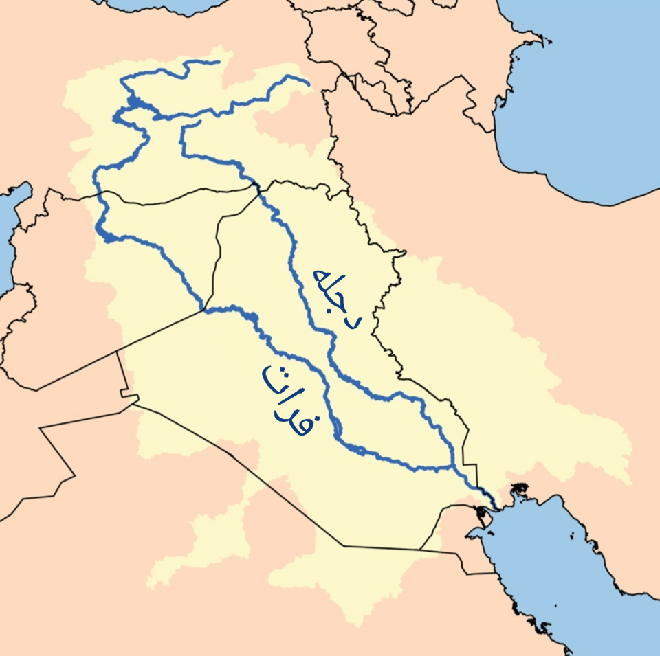
Which two rivers define the fertile lowland shown in the illustration?
A
The Tigris and Euphrates
✓
B
The Nile and Congo
C
The Indus and Ganges
D
The Jordan and Litani
The Tigris and Euphrates cross Iraq and form its great alluvial plain.
Play Iraq · Geography
More Geography questions
Which major Iranian city lies closest to the ruins of Persepolis?
The Aras River defines much of Iran's border with which neighbouring country?
What is Iran's largest island, located in the Persian Gulf and known for its coral reefs…
Iran shares land borders with how many countries?
Near which city do the Tigris and Euphrates join to form the Shatt al-Arab?
What is the Arabic name commonly used for Iraq's southern marshlands?
Which large lake lies northwest of Baghdad near the Euphrates?
Which major river flows through Baghdad?